
New Brunswick, Newfoundland & Labrador, Nova Scotia, Ontario, Prince Edward Island, Québec.
Colonized by the English and the French during the 16th century, Canada’s eastern provinces are still marked by their dual influences. They contain the last fragment of once-sizeable French territories, St. Pierre and Miquelon islands. French remains Canada’s second official language and Québec’s first language. The population of the eastern provinces is highly concentrated in the south, especially along the border with the US.
A recent decline in fishing in the Atlantic provinces has encouraged a steady flow of westerly migration to more prosperous regions. The north, around Hudson Bay, remains snow-covered for most of the year and the indigenous Inuit people make up the bulk of its sparse population.
The landscape of the eastern Canadian provinces
Much of eastern Canada is part of the Canadian Shield. Glaciers have scoured the land, leaving deposits dammed and diverted streams to create a rocky landscape with lakes and swamps. Much of the ground is subject to permafrost, which further impedes drainage. The uplands in the far east are the most northern extension of the Appalachian mountain chain.
Interesting facts about the eastern Canadian provinces
- The Péninsule d’Ungava is littered with erratics – isolated rocks carried by glaciers and deposited away from their place of origin when the glacier melted.
- Labrador’s indented coast is a product of past glaciations, which caused the sea-level change and wave erosion. There are countless offshore islands, fjords, and exposed headlands.
- Lake Superior is the world’s largest expanse of fresh water, covering 83,270 sq km (32,150 sq miles). The Canada–US border crosses it.
- The forested Laurentides Park incorporates part of the Laurentian Mountains. Within its boundaries are over 1600 lakes.
- The eroded highlands of New Brunswick, Nova Scotia, and Newfoundland are part of the Appalachian mountain chain, formed over 400 million years ago.
- At the Bay of Fundy, incoming waves are funneled down the long, narrow, steep-sided bay. These topographical features cause fast-flowing tides, which can rise 21 m (70 ft).
- The tides at the Bay of Fundy are among the highest globally. At low tide, the tree-topped rocks have been likened to flowerpots.
Transportation & industry in the eastern Canadian provinces
Both Québec and Ontario have a diversified manufacturing sector located in the south. Across the rest of the region, the industry is primarily based on local resources, which account for many fish and timber processing plants and mines. Many of the fast-flowing rivers are also gradually being harnessed for hydroelectric power.
Using the land & sea in the eastern Canadian provinces
With thin soils restricting farming to the south, the forests that grow in vast unbroken tracts across eastern Canada provide an essential source of revenue. Coastal communities rely heavily on the rich fishing grounds of the Atlantic Ocean, although foreign competition and overfishing have resulted in strict policies to conserve stocks.
New Brunswick
Formation: 1867.
New Brunswick is the second smallest province in Canada. It has around 750,000 people and an area of just over 50,000 square kilometers. New Brunswick is home to the third-highest number of Francophones outside of France. It borders only one other Canadian province: Quebec. The capital of New Brunswick is Fredericton, and its largest city is Moncton, with about 150,000 people.
New Brunswick is a crown jewel in Canada’s maritime provinces. It has a rich and diverse culture, including agriculture, forestry, fishing, mining, and tourism. It is a beautiful place that is rich in culture and nature. The capital has many historical buildings and museums to explore. While it doesn’t offer much in terms of outdoor activities, there are plenty of lakes close by where you can go to enjoy the scenery.
Read more and find maps here about New Brunswick.
Newfoundland & Labrador
Formation: 1949.
The province of Newfoundland and Labrador covers an area of Canada on the northeastern Atlantic coast. It is a rural region close to the Atlantic Ocean. Gros Morne National Park is a UNESCO World Heritage site in Newfoundland. The park is noted for its geological features, including tablelands with exposed layers of rock and millions of years old caves.
This province has many natural resources, including hydroelectric power, fishing, forests, and minerals. The landscape consists of beautiful coastlines on the Atlantic Ocean, inlets, lakes, and rivers. There are also many hiking trails in Newfoundland and Labrador.
It is a sparsely populated area; most of the population lives on the rugged west coast, where fishing and tourism are important industries. Tourism is also a key industry in Gros Morne National Park in central Newfoundland, which has some of the oldest fossilized trees in the world.
Read more and find maps here about Newfoundland & Labrador.
Nova Scotia
Formation: 1867.
Nova Scotia is a Canadian province with two central coastal regions: the northern and southern maritime regions. The province’s capital city is Halifax, and it also has Lamentin, Dartmouth, Bedford, and Antigonish as some of its other major cities. Nova Scotia is one of Canada’s smallest provinces, but it is still very diverse due to its rugged coastlines, forests, and highlands.
Many natural resources are found, including fossil fuels and minerals like gold, silver, copper, and gypsum. It also has a booming fishing industry, with lobster as its most popular product.
Read more and find maps here about Nova Scotia.
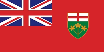
Ontario
Formation: 1867.
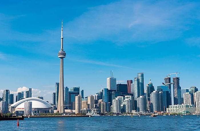
Ontario is Canada’s most populous province and home to the country’s capital, Ottawa. Ontario is also Canada’s economic engine, with a diverse economy including agriculture, manufacturing, and financial services. The province boasts 12 universities, two of which are among the oldest in North America.
It has 14,571,494 people living there (2019). It’s also the third-largest province in size and is landlocked by Manitoba to the west, Quebec to the east, Hudson Bay to the north, and the US state of Minnesota to the south. Ontario’s name originates from an Iroquois meaning “beautiful lake-filled land”. The province was first explored by Frenchman Étienne Brûlé in 1620 and later surveyed by John Innis as part of an expedition for a canal connecting Lake Superior and Lake Huron (1821).
Toronto, Ontario’s capital, is one of North America’s most extensive and diverse cities. The city is home to many different cultures, languages, beautiful buildings, museums, and landmarks.
Read more and find maps here about Ontario.
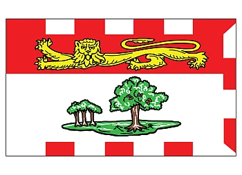
Prince Edward Island
Formation: 1873.
Prince Edward Island, a Canadian province and the smallest in the country, is located on a large island off the east coast of Canada. Its mild weather, sandy beaches, and beautiful scenery are called “Canada’s Summer Playground.” The Island has one city of any significant size (Charlottetown, home to many historic buildings and museums) and relies heavily on seasonal industries such as lobster fishing and farming. Residents are mainly English-speaking, with French minority speakers in some rural areas.
Prince Edward Island is a Canadian province with a population of about 140,000. It is located in the Gulf of Saint Lawrence, along the eastern seaboard in Canada. The Island was named after Prince Edward Augustus, the Duke of Kent.
The Island includes several communities, towns, and villages scattered across its landscape. The population density is 42 people per sq km, meaning it’s one of Canada’s least densely populated places. Tourists have many natural attractions, such as sandstone cliffs, beaches, and clear blue waters.
Read more and find maps here about Prince Edward Island.
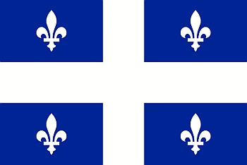
Québec
Formation: 1867.
Québec is a province in Canada that is just north of Vermont. It is the largest province in Canada and is known for its food and culture, and is Canada’s only officially French-speaking province. The capital of Québec is Québec City, which is where you’ll find the historic Citadelle and the Musée national des beaux-arts du Québec.
It is shaped like an upside-down triangle, and it borders Canada’s two other provinces, Ontario and New Brunswick, and the United States’ state of Maine. The most populated city in Québec is Montréal, home to over 15% of Quebec’s population.
Niagara Falls, a popular tourist attraction in Canada and the US, is located on the border between the two countries at the southernmost point of Ontario.
Read more and find maps here about Québec.
You may also be interested in the