
The Cordillera is a region, or belt, of the Andes Mountains in South America. The Cordillera includes both Chile and Argentina. This mountainous area extends the length of the western third of North and South America. The mountain system includes parts of Colombia, Ecuador, Bolivia, Peru, and other countries in the Western Hemisphere.
The Spanish word “cordillera” means “parallel ridges,” This region refers to the mountains and valleys running from north to south in parallel. The region is home to many young mountain ranges, including the Coastal and St. Elias Mountains, and is also known for its scenic inlets called fjords. The region poses many engineering difficulties due to its topography but is nonetheless densely populated in areas with access to the Pacific Ocean.
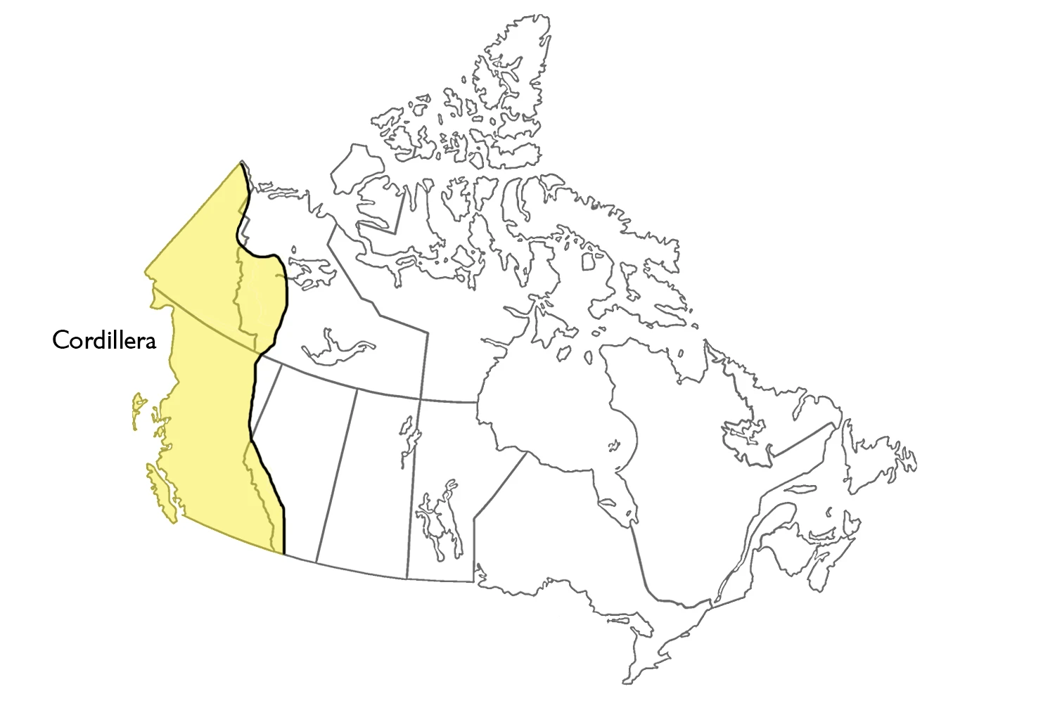
This Canadian region is part of the mountain system extending the western third of North and South America. The Canadian part of the Cordillera is about 800 km wide and extends from southern British Columbia north to the Yukon and the Beaufort Sea. While most of the Cordillera lies within these regions, it extends into southwestern Alberta and the Northwest Territories. The total area covered by this physiographic region is 1.6 million km2 (16 percent of Canada).
The Cordillera contains plateaus, valleys, plains, and rugged mountains. The most common mountain chains include the Coast and the Rocky Mountains, from high rims along the southwestern and southeastern sides of a belt of varied terrain.
There are three main mountain systems in the Cordillera. The Eastern system includes sedimentary rocks tilted, faulted, and folded. The Interior system has mountains and dissected plateaus underlain by folded sedimentary layers of volcanic rock, metamorphic rocks, and numerous minor igneous intrusions. The Western system consists of a mass of interconnected igneous intrusions and metamorphic rocks. The westernmost mountains, the Haida Gwaii and Vancouver Island ranges, are geologically similar to the Interior system.
The Cordillera’s most ancient feature is the gently rolling terrain of its interior plateaus. This original surface was sculpted by long-ago erosion but has since been uplifted, partly buried by lava flows, dissected by river erosion, and modified by glaciers. The most widespread landforms and surface deposits of the Cordillera date from the glaciations of the past million years. South of 60° N, only the highest mountain peaks were above the Cordilleran ice sheet. Farther north, extensive parts of Yukon, Nunavut, and Northwest Territories.
In glaciated areas, landforms such as U-shaped valleys and cirques are common. Features such as valley striations, drumlins, eskers, and tills plains are widespread on plateaus. Valleys and lowlands often contain silts and clays deposited in ice-dammed lakes during glacier melting and sands and gravels deposited by meltwater streams.
Following the last ice age, rivers and other water bodies in the world have created landforms like alluvial fans, deltas, valley sides, and ridges. Permafrost exists at high elevations in southern regions but becomes lower as you move northward. In northern Yukon, permafrost is present at all altitudes.
Volcanic activity in Cordillera has occurred sporadically at scattered locations in the Western and Interior systems up to the present. Some eruptions occurred during glaciation. The youngest lava flows and cinder cones are only a few hundred years old; these eruptions are described in certain legends told by Aboriginal peoples.
The Cordillera mountain range has a great variety of climates because it spans a large latitudinal extent, is located between the Pacific Ocean and the continental interior, and has severe terrain. Several significant effects of this climate on the natural landscape are apparent—heavy rain and snow on the Coast Mountain Range give rise to dense forests and maintain extensive snowfields at low elevations.
The timberline (the top of the forest’s upper limit) and the snowline rise eastward as snowfall decreases and descend northward as temperature declines. Altitudinal vegetation zones reflect differences in climate caused by elevation in any particular area. The highest of these is the alpine tundra. In the semiarid valleys of the Interior system, the lowest vegetation zone is grassland.
The Cordillera has a lot of different textures. It is notable for its mountainous and rugged topography and its great variety of climates and soil types. Many natural features restrict how people can use the land, including steep slopes, natural risks, and severe weather conditions. Forests, grasslands, and lakes are also natural resources.
The Google Maps of Cordillera
Interactive Google maps of Canada; Search for a place, zoom, look at the Street View, and create free driving directions with Google maps. Click here if you’re looking for free Driving Directions in Canada.