
The Interior Plains are a significant natural region in Canada. It surrounds Western Canada and Eastern Canada and is bordered by the Rocky Mountains to the west and the Appalachians to the east.
The Interior Plains form an immense region of nearly level grassland bordered by the Canadian Shield to the east and the Canadian Rockies to the west. Ancient Lake Agassiz, formed nearly 12,000 years ago from glacial meltwater, once covered much of the southern Interior Plains, especially Manitoba and Saskatchewan. After “drying up” approximately 7,000 years ago (the largest body of water remaining from Lake Agassiz is present-day Lake Winnipeg), a rich layer of soil was left behind on the former lake bed. This soil forms the basis for much of central Canada’s agricultural wealth. Rich grain-producing regions in Alberta and Saskatchewan, of wheat especially, make Canada one of the world’s major exporters of grain. Surprisingly, the waving fields of golden wheat so familiar to the landscape today were introduced by farmers only in the last century. The Red Deer River Valley in southern Alberta is home to strange-looking sandstone pillars called “hoodoos.” These pillars are created by the erosive effects of wind and water, and erosion in the area has also led to the discovery of dinosaur fossils. Humans have used the Athabasca Oil Sands in Alberta for centuries, and First Nations peoples have been utilizing the oil sands since at least the late 1700s.
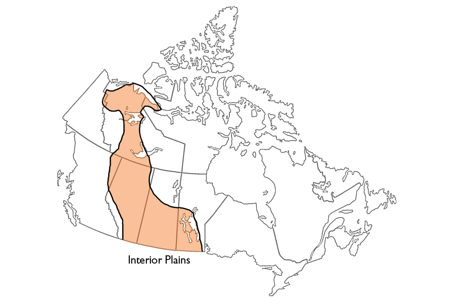
The region known as the Interior Plains extends from the Canadian Shield to the western ranges. It covers over 1.8 million km2 and 18% of Canada’s land surface, primarily sedimentary rock in low-grade format. Bedrock relief plays a role in large-scale physiographic features, but small-scale features are primarily the result of Quaternary glaciation (2.6 million to 10,000 years ago). Where the Interior Plains extend northwards, as in the Northwest Territories, they become subarctic. Even further north in the islands of the western Canadian Arctic, they constitute genuinely arctic tundra lowlands.
The regional topography is partly determined by flat-lying limestones and shales of marine origin, which underlie the entire region. Younger, non-marine sediments – sand and gravels representing deposits from rivers pouring eastward from newly developing mountains – covered these marine sediments in the region’s western part. The eastern part of the southwestern US is made up of more durable sediment, resulting in the carving of the western part of this region into high, narrow peaks. The less resistant sediment was eroded, and uneven pitch formed the carvings.
The southern part of the region is divided into three levels, each of which is a step from the Manitoba Escarpment and Missouri Coteau. The first level is the Manitoba Plain in the southeast, which lies below the Manitoba Escarpment at under 400 meters elevation. The Manitoba Plain is the lowest and flattest of the three prairie steps. Underneath are Palaeozoic rocks that are about 544-250 million years old.
The next step to the west is the Saskatchewan plain. Along with Manitoba Escarpment, it is underlain by marine shales from the Cretaceous age. Glacial deposits cover the bedrock but not as thoroughly as in most other areas of the province. Saskatchewan Plain is lower in elevation and smoother than the other plains in Western Canada. The elevation ranges from 460 feet to 790 feet on flat ground. It reaches up to 915 feet in hillier areas.
The Missouri Coteau is west of the Saskatchewan Plain and represents the 3rd step in the terrain. Beyond this coteau, there are two more steps. The Eastern Alberta Plains are less elevated than the Missouri Coteau, whereas the Western Alberta Plains reach 1,100 meters. Most striking are the badlands, formed from the dissection of soft underlying rocks in Southern Alberta. This reflective relief is due to the proximity of the erosion-resistant bedrock surface in many areas. Cypress Hills is isolated and not part of the Southern Alberta Uplands.
The Northern Alberta Uplands are a series of disconnected plateaus that rise 250-700 meters from the surrounding Northern Alberta Lowlands to summits ranging from 760-1,050 meters. The valleys of the Peace, Athabasca and Hay rivers are impressive features in the lowlands. Most flat areas on the plateau have a layer of glacial till, while peat lakes are common low-lying areas in the lowlands.
The Interior Plains almost go from the Arctic Ocean to Canada, where the Arctic coastal plain and lowlands bound them. Levels around the Mackenzie River Valley tend to be lower than elsewhere, rising slowly but more dramatically in some places to meet the Precambrian Shield.
The southern Interior Plains are characterized mainly by grassland vegetation under semiarid climatic conditions throughout the plains. Still, islands of mixed-wood forest prevail at high elevations on uplands in western Alberta. The grassland gives way to a parkland of aspen trees. Under slightly cooler temperatures, there is more precipitation, meaning that this trend continues northward, and the forest becomes dominated by coniferous trees or evergreens. Finally, at the northern extension of the Interior Plains, it transitions to treeless tundra and polar deserts.
The Google Maps of the Interior Plains
Where are the Interior Plains located in Canada?
The Plains region is in between the Cordillera and the Great Canadian Shield. It is found in the Yukon, Northwest Territories, British Columbia, Alberta, Saskatchewan, and Manitoba.